
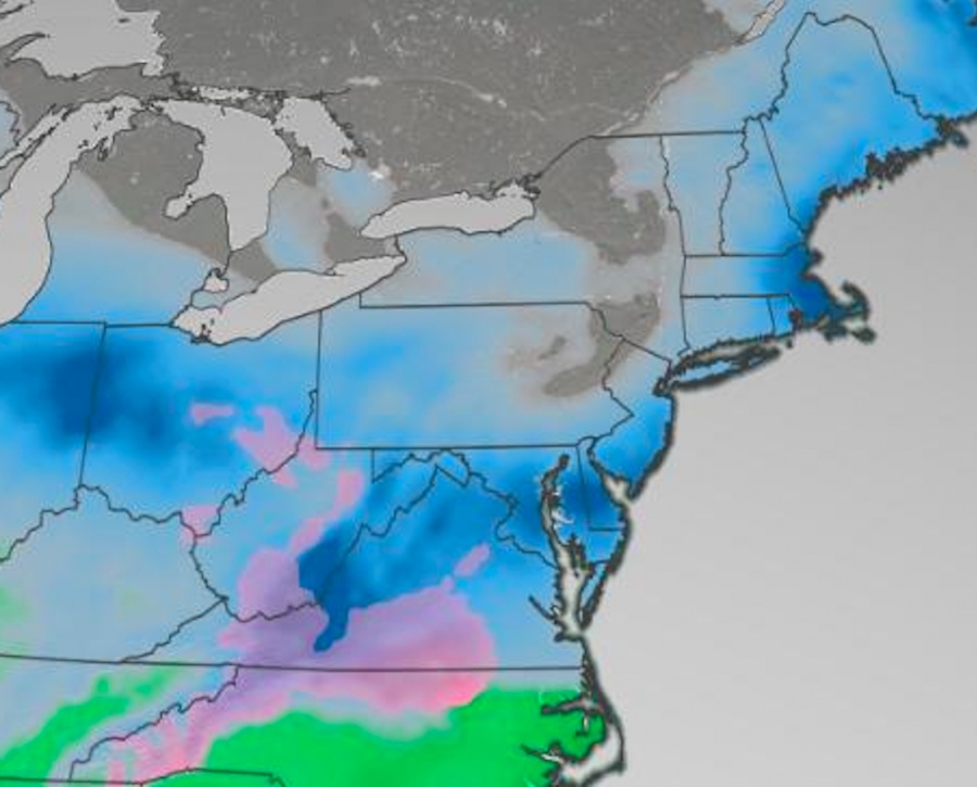
The National Weather Service issued a Winter Storm Watch for much of central and southern New Jersey. On Sunday, the snow and wintry mix will spread into the Mid-Atlantic region before a potential Nor'easter intensifies and significantly impacts portions of the Mid-Atlantic, Northeast and New England on Monday and Tuesday. Heavy mixed precipitation possible with total snow accumulations of 4 to 12 inches and ice accumulations of around one tenth of an inch possible. Winds could gust as high as 35 mph. Travel could be very difficult to impossible. The hazardous conditions could impact the morning or evening commute. Snow will develop west to east late Sunday and last through late Monday or early Tuesday. A period of wintry mix or rain could occur Sunday night and Monday morning, especially along and near the coast, before turning back to snow Monday night. The highest snowfall rates are most likely to occur Sunday night and Monday morning.
Published in
News
Leave a comment
Make sure you enter all the required information, indicated by an asterisk (*). HTML code is not allowed.