


























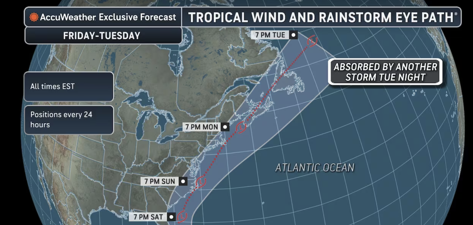
Confidence continues to increase in a coastal low being near the Mid-Atlantic coast late Sunday into Monday bringing periods of rain to the area, however the exact details remain uncertain,” the National Weather Service said early Friday. A potential tropical system could hit state with heavy rain, strong winds starting Sunday with chances that a coastal storm will strengthen into a tropical system increasing and New Jersey likely to face heavy rain, gusty winds and flooding. A non-tropical low pressure system is expected to form along the front near the northwest Bahamas on Friday and could become a subtropical or tropical storm while it moves northward or northeastward near or just offshore of the southeastern U.S. coast through the weekend. Regardless of development, strong winds, dangerous surf, and coastal flooding are likely along portions of the southeast and mid-Atlantic coasts into early next week.
The system is expected to be near Cape Hatteras, North Carolina by Sunday night before continuing north toward New Jersey. Rainfall probabilities for New Jersey on Sunday are now in the 40% to 80% range. The highest probabilities are near the Jersey Shore. A strong cold front will push through the region on Monday, clearing the storm out and bringing a return of sunny skies and cooler temperatures by midweek.